Soil Type and Soil Erosion

Diwalwal Gold Mining

Diwalwal Gold Mining Community, Davao del Norte,

        Mindanao, Philippines

                 Humans don’t follow on how to segregate the garbage properly. Almost of the people living near a rivers throw                   

their garbage in the rivers. The effect of it would be a big flash flood, the water can’t flow freely because of the garbage that stack up in the bodies of the water.four climate types (Types I to IV), based on monthly rainfall received during the year. A province is considered to have Type I climate if there is a distinct dry and a wet season; wet from June to November and dry, the rest of the year. Type II climate is when there is no dry period at all throughout the year, with a pronounced wet season from November to February. On the other hand, Type III climate is when there is a short dry season, usually from February to April, and Type IV climate is when the rainfall is almost evenly distributed during the whole year. 

Climate and Hydrology

page

Projections on seasonal temperature increase and rainfall change, and total frequency of extreme events nationally and in the provinces using the mid-range scenario outputs are presented in this chapter. A comparison of these values with the high- and low- range scenarios in 2020 and 2050 is provided in the technical annexes. 

It is to be noted that all the projected changes are relative to the baseline (1971-2000) climate. For example, a projected 1.0 C-increase in 2020 in a province means that 1.0 C is added to the baseline mean temperature value of the province as indicated in the table to arrive at the value of projected mean temperature. Therefore, if the baseline mean temperature is 27.8 C, then the projected mean temperature in the future is (27.8 C + 1.0 C) or 28.8 C.

In a similar manner, for say, a +25%-rainfall change in a province, it means that 25% of the seasonal mean rainfall value in the said province (from table of baseline climate) is added to the mean value. Thus, if the baseline seasonal rainfall is 900mm, then projected rainfall in the future is 900mm + 225mm or 1125mm. 

This means that we are already experiencing some of the climate change shown in the findings under the mid-range scenario, as we are now into the second decade of the century. Classification of climate used the Coronas four climate types (Types I to IV), based on monthly rainfall received during the year. A province is considered to have Type I climate if there is a distinct dry and a wet season; wet from June to November and dry, the rest of the year. Type II climate is when there is no dry period at all throughout the year, with a pronounced wet season from November to February. On the other hand, Type III climate is when there is a short dry season, usually from February to April, and Type IV climate is when the rainfall is almost evenly distributed during the whole year. 

Topography and Vegetation

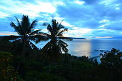
Samal_Island

The Davao Region has a total land area of 19,671.94 square kilometers or 6.6% of the Philippines’ total land area, and 20.7% of the total land area of Mindanao. Its population reached 5,558,699 in the 2010 Census with a density of 274.6 per square kilometers or 711.2per square miles. 
 
The region topography is dominated by peninsular and island topography characterized by extensive mountain ranges extending along the western border, in the northern central area and in the northwestern area leading to the peninsula in the southeast with uneven distribution of plateaus and lowlands. It has a coastline of 1,600 square kilometers. 
 
 
About 5,021.48 square kilometers, or 26% of the total land area of Davao Region has a slope range of 0-8% which is primarily for agriculture, industries, and settlement. Among the provinces in the region, Compostela Valley has the largest area with 1,300.9 square kilometers with a slope range of 0-8%, followed by Davao del Norte with 1,219.8 square kilometers. 
 
The soil of the Region may be classified into groups of inceptisols, alfisols, and ultisols which are  generally loam and clay types. The region’s soil is dominated by inceptisols. The alfisols and ultisols are found in depths beyond 100 feet.

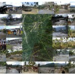
Pictures-show-worst-hit-areas-by-typhoon-Pablo.1-150x150

Land Area and Present Land Use

Samal,Davao del Norte

Samal,Davao del Norte

•Samal, Davao del Norte

City in Philippines

Samal is a 2nd class city in the province of Davao del Norte, Philippines. Its official name is the Island Garden City of Samal. It has a population of 95,874 people according to 2010 NSO Census.

Area: 301.3 km²Weather: 33°C, Wind E at 11 km/h, 52% Humidity